


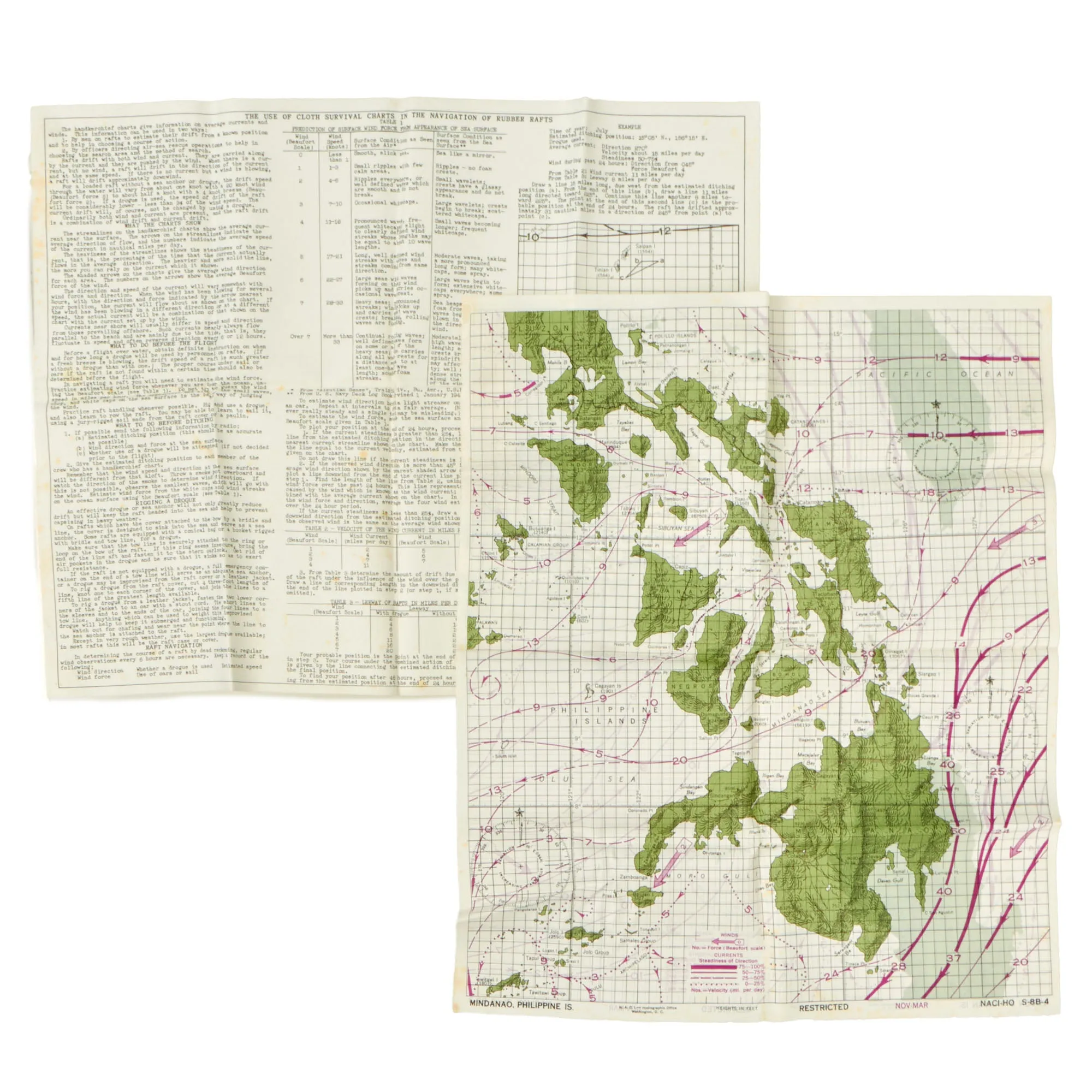

Original Item. Only One Available. This is a tremendous lifeboat survival map set issued aboard U.S. lifeboats during World War II. The map included is of Mindanao, Philippine Islands. The other sheet included is an instruction sheet labeled THE USE OF CLOTH SURVIVAL CHARTS IN THE NAVIGATION OF RUBBER RAFTS. This is a scarce piece not often found with these maps.
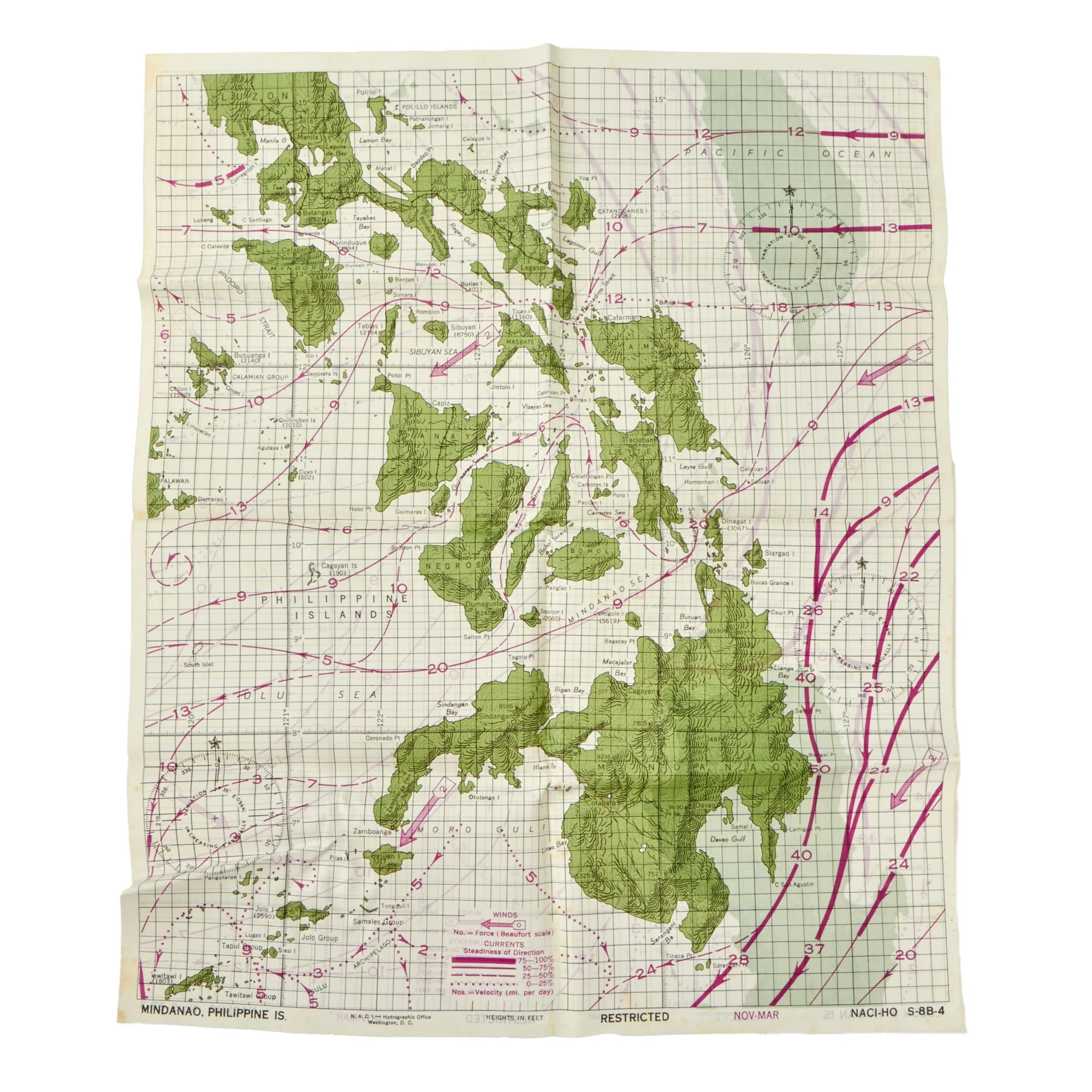
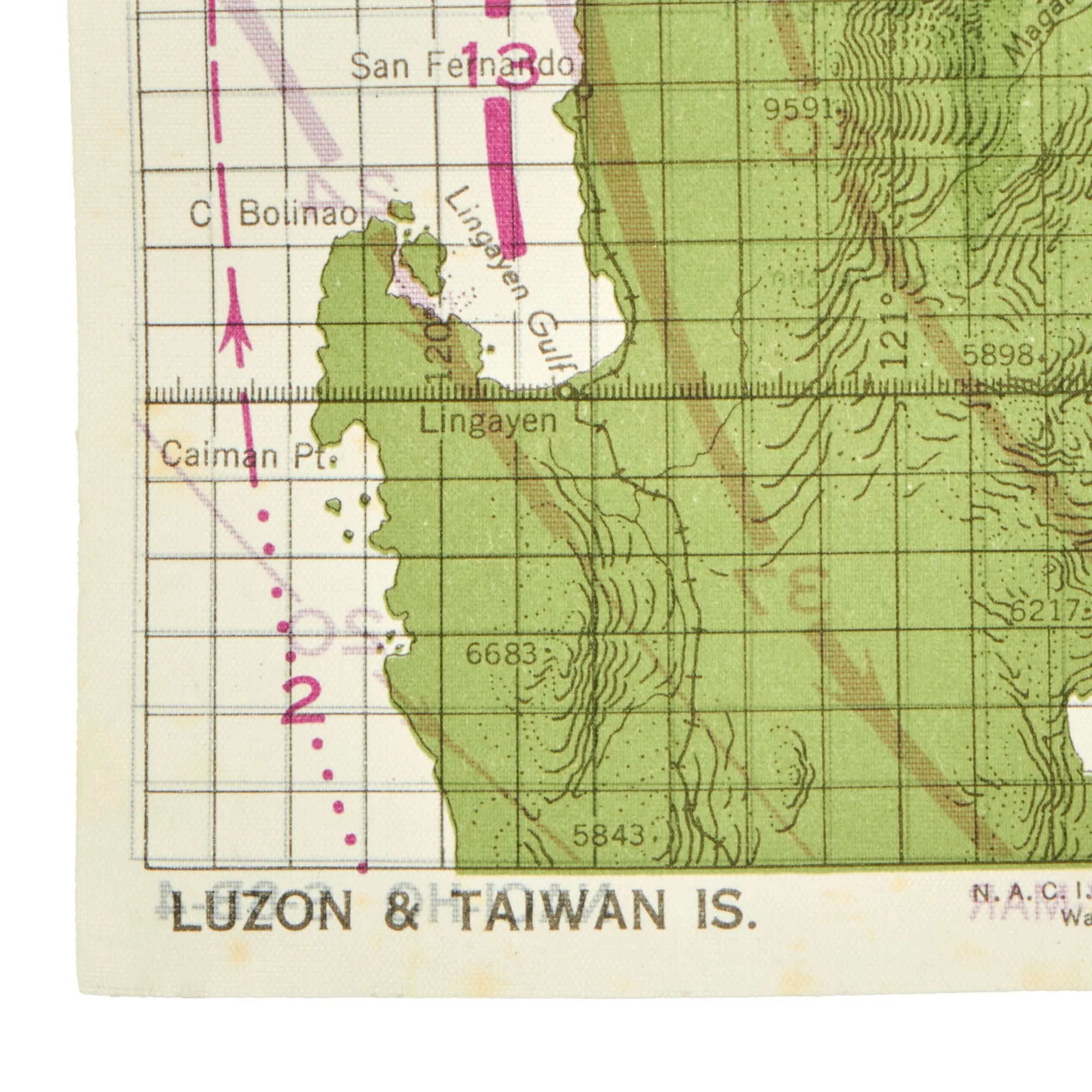
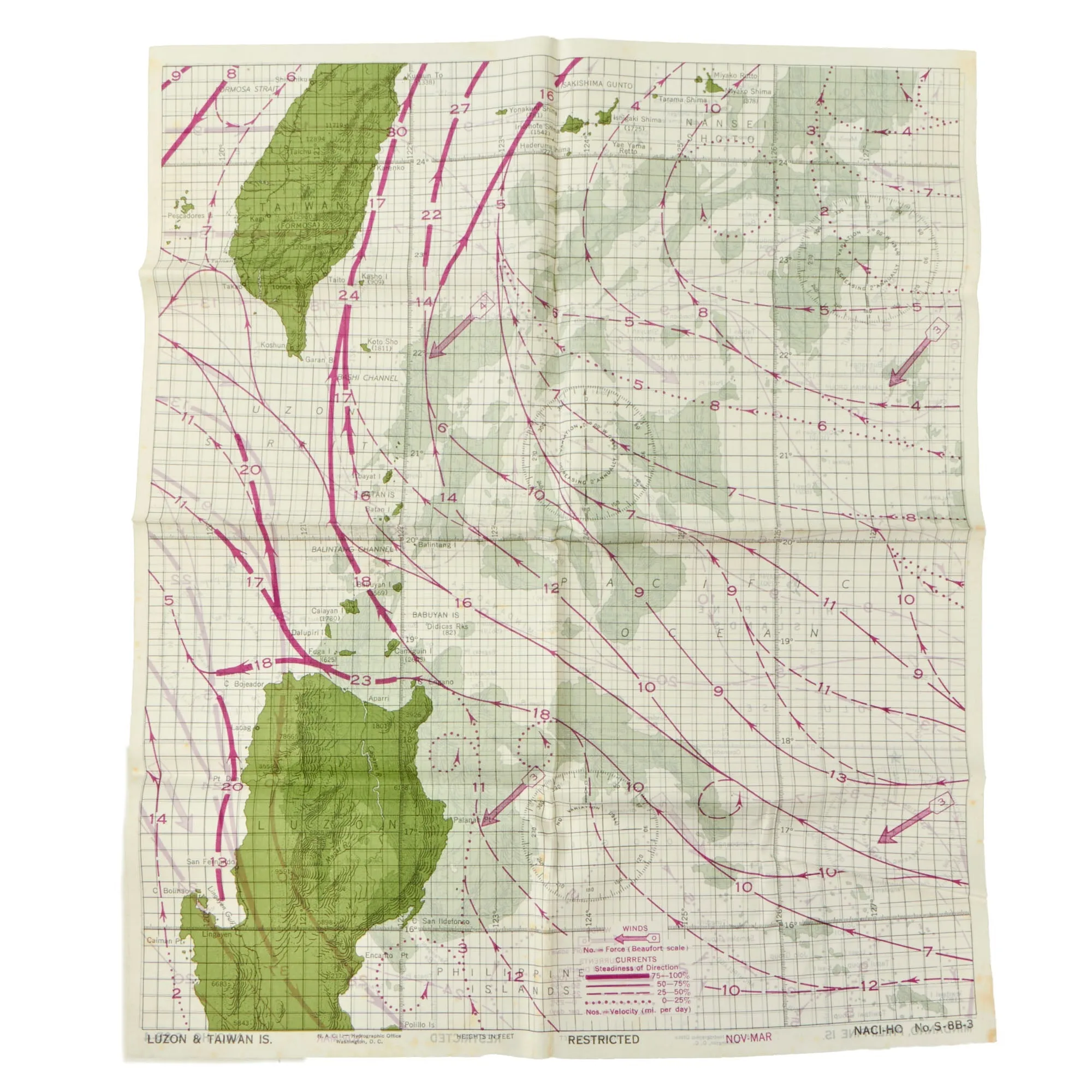
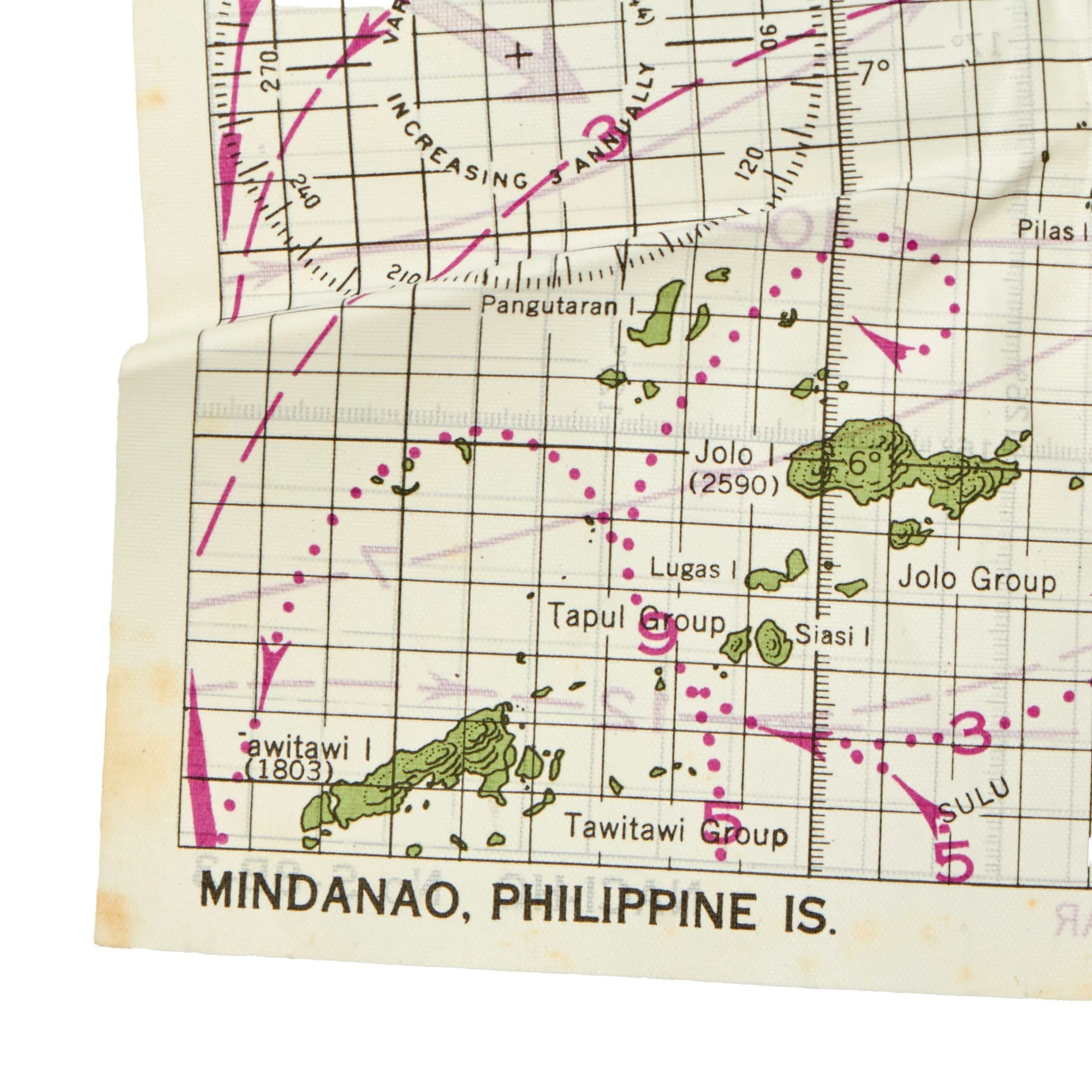
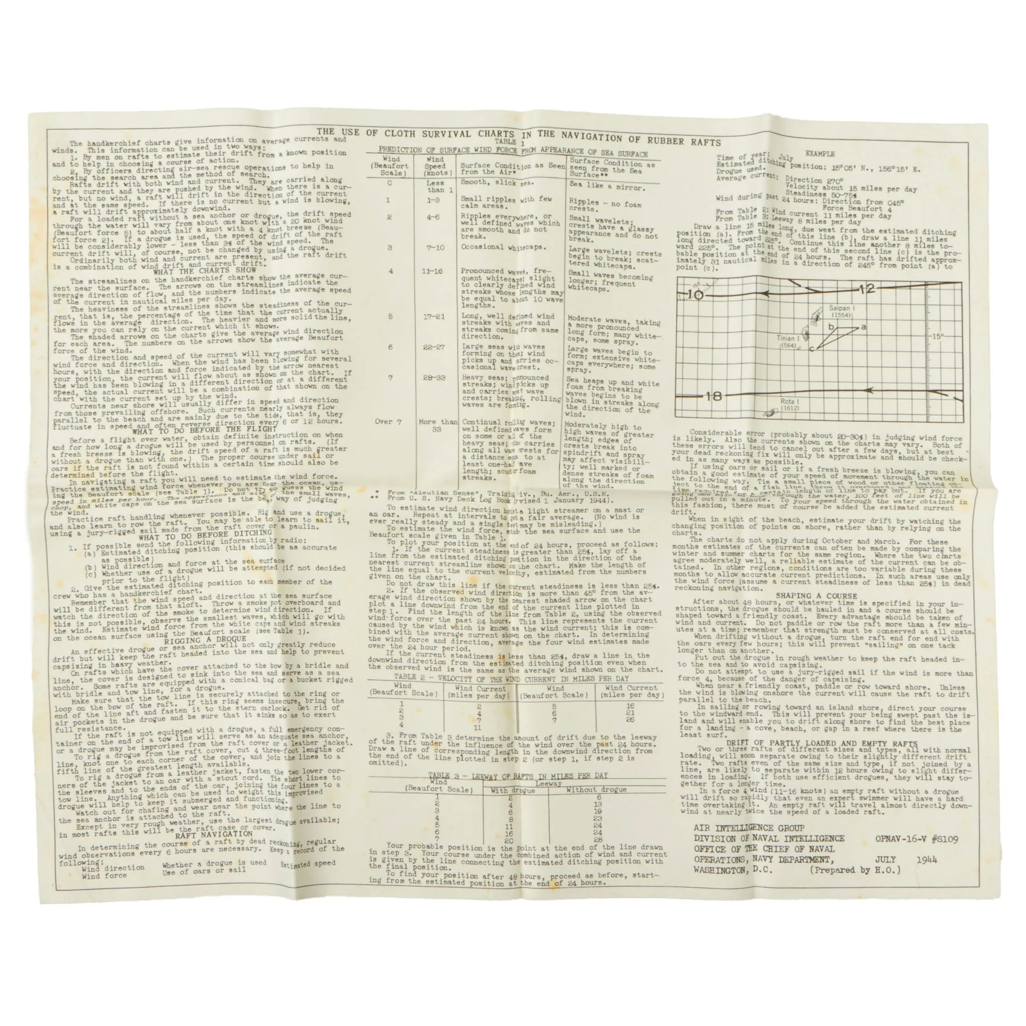
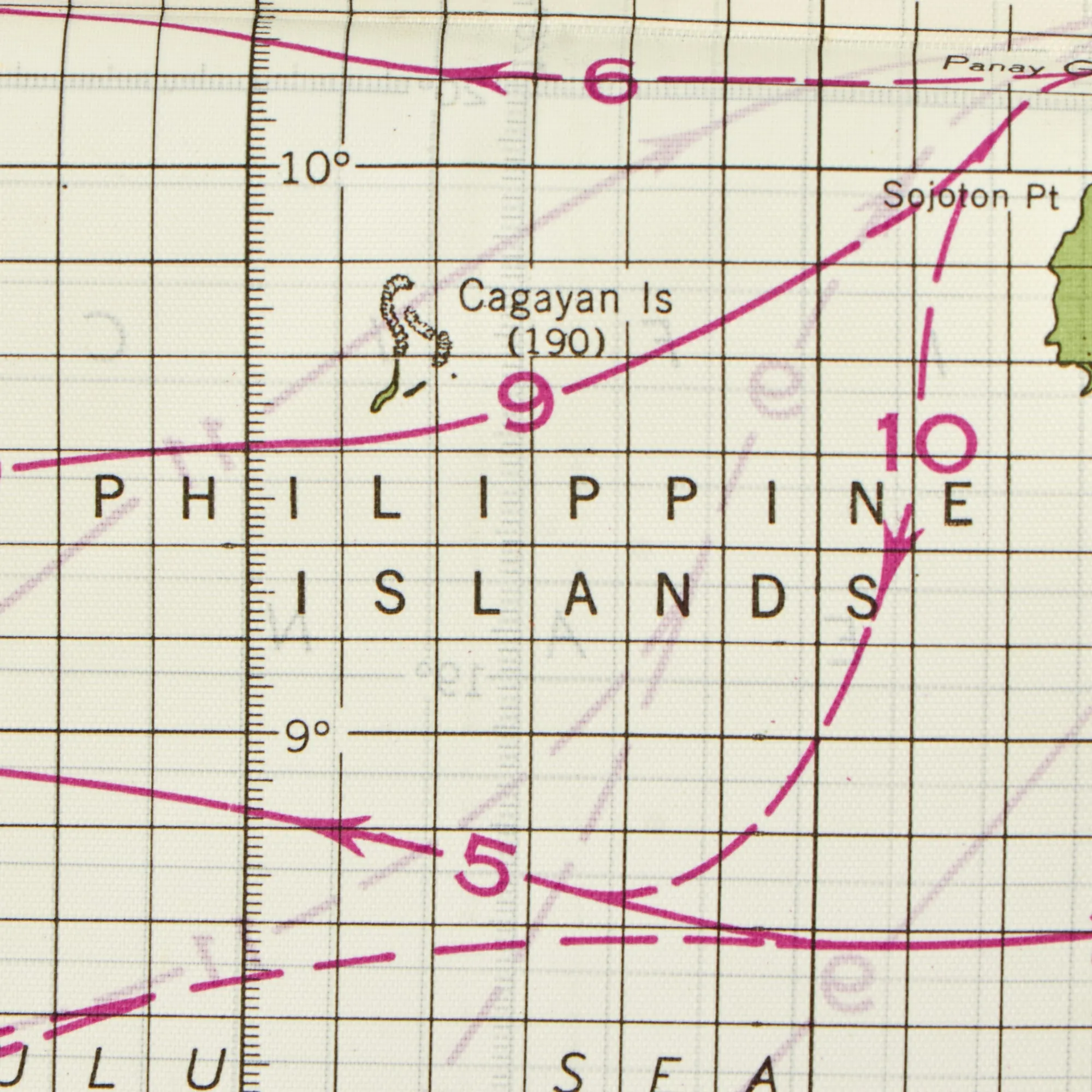
The instruction sheet was put together by the Air Intelligence Group, Division of Naval Intelligence, Office of the Chief of Naval Operations, Navy Department, Washington, D.C. and is dated July 1944. It only shows basic folding from storage. The map is double side and depicts the Philippine Islands and Luzon & Taiwan Islands, and shows escape routes via lifeboat depending on location. It is RESTRICTED marked and is marked to N.A.C.I. - HYDROGRAPHIC OFFICE WASHINGTON, D.C. The map codes are NACI-HO S-8B-3 & 4.
The map and instruction sheet both measure 12½ x 15½”.
This is a great set of maps in fantastic condition, ready for further research and display.


